

Geography and Map
Thrikkur Grama Panchayat
Thrikkur Grama Panchayat is located in Kodakara block of Mukundapuram taluk in Thrissur district. Thrikkur Panchayat, which is spread over Thrikkur and Kallur villages, has an area of 25.38 sq km. This panchayat, which has 19 wards, is bordered by Puthur Panchayat on the north, Alagappanagar Panchayat on the south, Alagappanagar and Nenmanikkara Panchayats on the west and Varantharappilly and Puthur Panchayats on the east.
Thrikkur Panchayat is a beautiful region with the Thrikkur River on one side and scenic green hills and stunning waterfalls on the other.
Map of Thrikkur Grama Panchayat
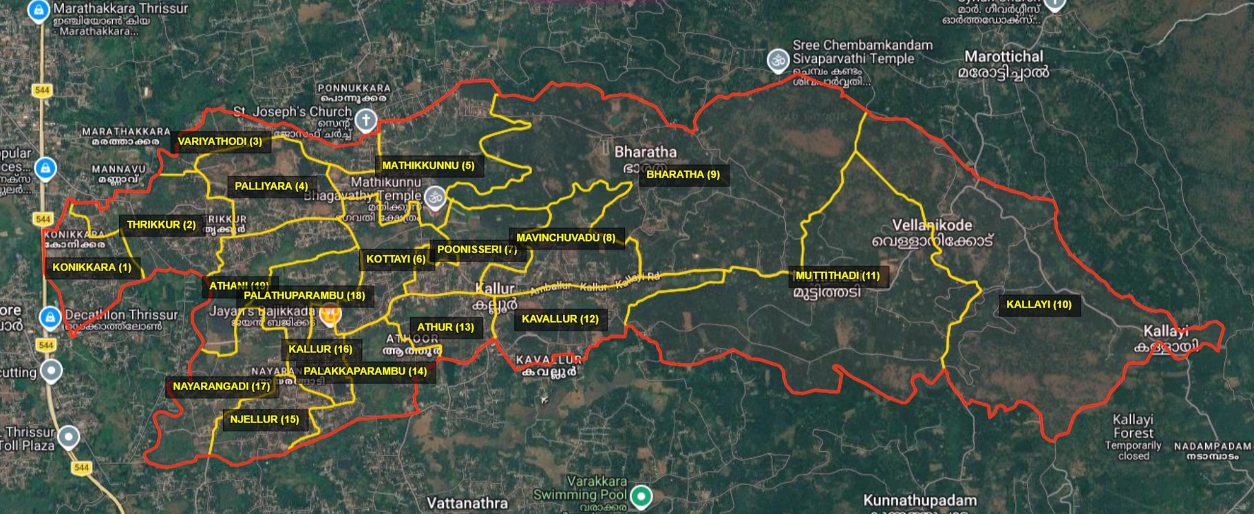
Panchayat Boundaries
Nature and Landscape
Green Landscape
Scenic, lush green mountain folds and the rural landscape enhance the distinctive natural beauty of Thrikkur Panchayat.
Thrikkur River
The Thrikkur River, flowing along one side of the panchayat, is a key element of the region's natural beauty and water resources.
Mountain Folds
Green-clad mountain folds lend a distinctive visual beauty to the landscape of Thrikkur Panchayat.
Waterfalls
The waterfalls found amidst the mountain folds are major attractions of the natural beauty of Thrikkur Panchayat.


